By SAJE Staff
In the City of Los Angeles, when a landlord wants to evict you, they have to file a notice of intent with the local housing department. These notices, typically warnings to fix lease violations or vacate the unit, are often resolved before an eviction lawsuit is filed and the case ends up in court.
Los Angeles does a pretty good job tracking landlords’ intent to evict, but neither the City nor the County track which eviction lawsuits make it to court. This lack of data makes it hard to understand how many renters are actually being displaced because of evictions, and where.
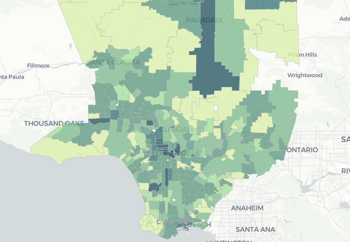
Since 2014, the Anti-Eviction Mapping Project, a volunteer corps of self-described “data nerds” and “radical cartographers,” has been collecting L.A. County eviction data to support the work of housing justice organizations and coalitions. This week, they launched an interactive map showing eviction lawsuit filings in Los Angeles County since 2018 by month, period, and zip code. An animated time series feature lets the user see the concentration of filings over time. The map relies on data from Los Angeles County Superior Court and will be updated quarterly.
Understanding where eviction lawsuits are happening in L.A. County is important. Policy makers can use this data to craft interventions that help vulnerable renters, such as assistance navigating the legal system. (Consider that in almost half of the eviction cases that end up in court, tenants lose by default, meaning they don’t properly respond to the paperwork and/or appear in court, not because they are in violation of their rental agreement.)
Kyle Nelson, SAJE director of research and policy, and a member of the Anti-Eviction Mapping Project, also hopes local housing rights groups will benefit from the map. “Organizers will be able to see who is getting evicted right now, but they’ll also be able to spot trends in displacement pressure over time, and how evictions may be multiplying in certain areas of the city and county,” he said.
According to Nelson, the map indicates zip codes around downtown L.A. have seen a spike in filings in recent years, as have South Central L.A., Palmdale, and Long Beach.
“Policy makers finally have real data on where actual evictions are happening. We hope this enables them to focus resources they will do the most good,” he said.